Neighborhood Information
The Westside ("west of State Street") lies predominantly in the lowlands between State Street and the Mesa, including Highway 101, and also reaches down to Cliff Drive, incorporating Santa Barbara City College.
Schools and Parks
Elementary Schools
Harding University Partnership School
McKinley Elementary School
Middle Schools
La Cumbre Junior High School
High Schools
San Marcos High School
Parks
Bohnett Park
Westside Housing Market
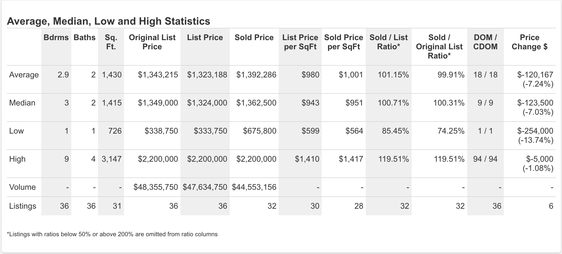
(Data for January 2022 - February 2023)
Disclaimer: Information is deemed to be reliable, but not guaranteed.
Information may be autofilled from county tax records and other sources, or input by listing agents and should be independently verified by users of such information. © 2023 MLS and FBS. Prepared by Andrew Rose on Tuesday, February 07, 2023 11:12 AM. All listings are pulled directly from the Santa Barbara MLS and may have similar names that can cause them to appear under the incorrect section.
Nearby Listings
Listing information provided courtesy of the Santa Barbara MLS. IDX information is provided exclusively for consumers' personal, non-commercial use, and it may not be used for any purpose other than to identify prospective properties consumers may be interested in purchasing. The data is deemed reliable, but is not guaranteed accurate by the MLS.
Updated: 12th June, 2026 11:47 PM (UTC).